To varying degrees, residents in the Western United States know all too well from years of drought conditions that having access to water is critically important. And when it's available, managing its use efficiently is a crucial undertaking, so as not to waste any of this precious resource.
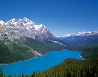
Such is the mindset of officials in the Colorado Basin area whose responsibility it is to allocate the massive water runoff from the melting snowpack of the Rocky Mountains. Their decisions affect approximately 33 million people in seven states – not to mention fish and wildlife – and the choices they make power (or curtail) activities for farmers, residents, energy-producing utilities and a range of other water-consuming groups. So not only is the water needed, knowing when it's coming is essential, as well.
But when officials were perplexed by an acceleration of melting snow – which threatened the accuracy of their water supply forecasts for those dependent groups downstream – these hydrologists, as they're called, turned to NASA – of all agencies – for help.
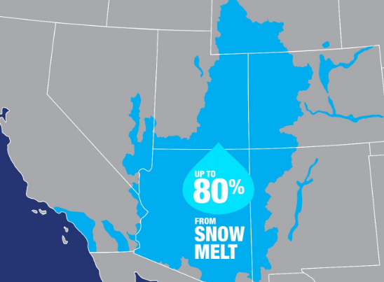
“The forecasts we get," said Dave Kanzer, a deputy chief engineer for Colorado River District in Glenwood Springs, Colorado, "provide crucial information," for the water runoff from snow, which accounts for 80 percent of the basin area's annual precipitation (image courtesy of NASA). "If we receive less water than the forecasts predict, we won’t have enough saved in the reservoirs to keep the river flowing throughout the irrigation demand season. Conversely, if we receive more than forecasted, we could have to release extra water, without causing damaging floods.”
 The forecasts, however, started proving inaccurate in 2009 as hydrologists began noticing never-before-seen blankets of dust from the Colorado plateau. This darker layer descended upon the Rockies' pristine snow, and the particles greatly sped up the melting process because they absorbed sunlight that the pure, white snow ordinarily reflects.
“We found that really dusty conditions increase the rate of snowmelt about as much as raising the temperature by 1 to 3 degrees Fahrenheit,” said Stacie Bender, a hydrologist at the Colorado Basin River Forecast Center, who was quoted in a NASA release. “It became very clear that we had to identify a more precise way of measuring dust on snow,” which relied partly on visual, human evaluations.
When Bender and her colleagues learned that NASA's Jet Propulsion Lab in Pasadena, CA was tapping orbiting satellites for its SnowEx project, which among other things focused on the impact of dust on snowpack, a joint-venture soon began and space technology helped fine tune the center's projections. The Forecast Center "began to incorporate two sets of remotely sensed data into its forecasting model," according to NASA. "The first set gave them a more accurate reading of where the snow was located, while the second provided them with a clearer picture of the snowpack’s surface conditions and specifically the amount of additional sunlight absorbed by dust contained in the snowpack."
NASA's satellites have been employed by the agency's scientists for SnowEx, billed as "a multi-year airborne snow campaign ... that seeks learn how much water is stored in Earth’s terrestrial snow-covered regions." The project's goal, according to the The Daily Sentinel of Grand Junction, Colorado, is "to determine how to deploy a suite of sensors in satellites in space as a means of measuring snowpack at a global scale to a degree now not possible."