Have you ever had this experience traveling to an unknown destination?
You think you're headed in the right direction, and using a combination of gut instinct and your dashboard GPS to navigate, you realize that you've overshot your turn ... resulting in you becoming completely upset and totally lost.
The next time that happens, perhaps you might take solace thinking about another type of traveler, one who faced a few challenges of his own. He was forced to rely on the wind, weather and the stars to navigate the mysterious and perilous Pacific Ocean, searching for a spit of land hundreds, if not thousands, of miles away.
Sure, it's a different context. And that's the point. Because sometimes it's comforting to take a step back from modern life's minor annoyances to appreciate the science (no matter how rudimentary) and extraordinary ingenuity that has fueled human exploration.
My guess is that thought has crossed the mind of anthropologist Scott Fitzpatrick, a professor at the University of Oregon, who along with two colleagues is giving today's scientists insight as to how ancient seafarers likely used climate conditions to discover and eventually populate some of the "most remote regions on Earth."
Working with geographer Alvaro Montenegro from Ohio State University and archeologist Richard Callaghan from the University of Calgary, Fitzpatrick's team produced an analysis that, according to their newly-released paper (subscription required), uses "databases of wind, currents, precipitation, and land distribution in the region to estimate seafaring and 'shortest hop' trajectories from likely origin points and seasonality of departure for peoples who colonized five major regions of the Pacific."
One of those five is the Hawaiian archipelago, settled between 700 and 800 years ago.
“Where did these people come from?," asks Fitzpatrick. "How did they get to these really remote places, and what were the factors, culturally, technologically and politically that led to these population dispersals?”
According to the authors, the paper, titled “Using Seafaring Simulations and ‘Shortest Hop’ Trajectories to Model the Prehistoric Colonization of Remote Oceania," and published this week in the Proceedings of the National Academy of Sciences, sought to reconstruct "some of the greatest feats of seafaring in human prehistory."
Their research, according to a University of Oregon release, utilizes "high-resolution satellite data sets that have only recently been made available to scientists," allowing the team to break new ground in the area of trans-Pacific migration from the various regions of southeast Asia to the far-flung area known as Remote Oceania.
The team focused on explorers' travels, beginning approximately 3,400 years ago, to these areas:
- western Micronesia (Palau and the Marianas)
- central and eastern Micronesia (Chuuk, Pohnpei, Kosrae, and the Marshall Islands)
- the Marquesas and Society Islands
- Hawai’i and New Zealand
- Easter Island
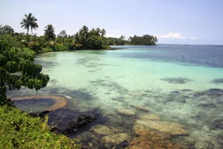
Remote Oceania, in the South Pacific Ocean (image courtesy of University of Oregon)
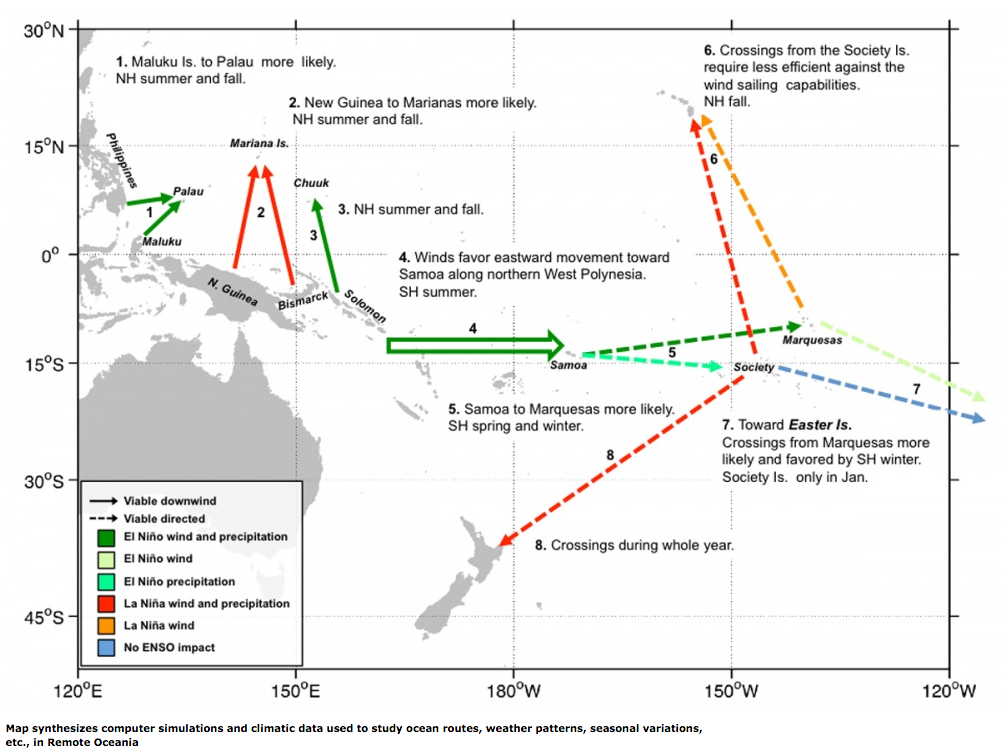
The researchers believe that early explorers, even those from thousands of years ago, were aware of recurring weather patterns -- which we know today as El Nino -- and timed their west-to east ocean journeys to take advantage of wind propulsion when the pattern re-emerged every three to seven years.
Their work also "suggests Samoa was the most likely staging area for colonizing East Polynesia," the university's release states. "It also indicates that Hawaii and New Zealand may have been settled from the Marquesas or Society Islands. Easter Island may have been settled from the Marquesas or Mangareva."